Precision Site Prep That Cuts Risk, Time, and Cost
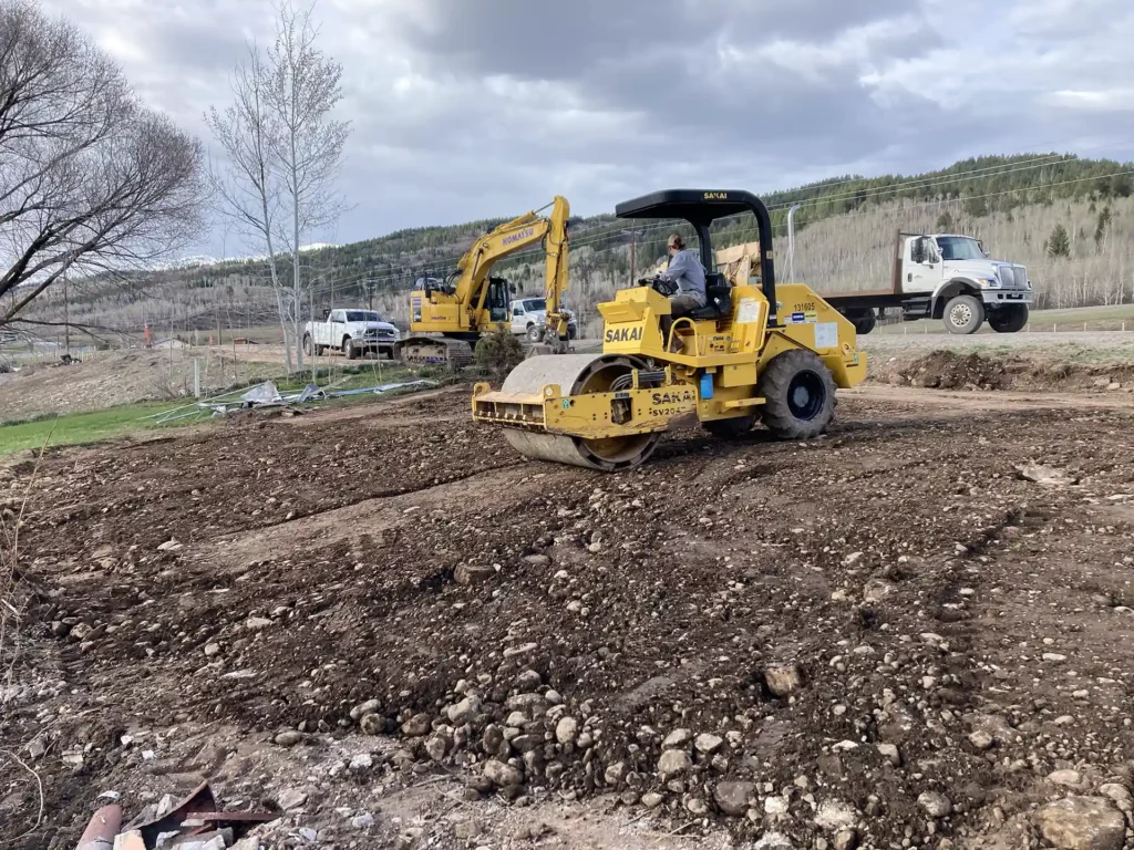
Great Divide Earthworks uses machine control GPS to bring industrial-grade accuracy to residential and commercial earthwork. The technology pairs digital site models with on-board guidance on dozers, graders, and excavators so operators can cut and fill to exact design elevations without constant manual staking. The result is cleaner build pads, controlled drainage, and fewer material moves, outcomes that matter whether the project is a rural driveway, commercial pad, or residential site near Alpine.
Machine control GPS reduces the traditional back-and-forth between survey crews and operators. After a model is loaded into the machine, the operator receives real-time elevation feedback and visual guidance, which cuts the need for repeated grade checks and lowers the chance of costly rework. This approach shortens schedules and improves predictability for follow-on trades like foundations and paving.
Key Components and How They Work
The system combines reliable hardware with accurate digital data to guide heavy equipment precisely.
- On-board GNSS/GPS receiver and cabinet display that show cut/fill information in real time.
- A digital site model created from survey data or engineered plans and uploaded to the machine.
- Sensors and tilt/angle compensation on the implement (blade, bucket, or box) to maintain correct orientation.
- Optional base station or network corrections for centimeter-level accuracy on critical projects.
These components work together so the machine effectively becomes a mobile, high-precision grader. Operators still interpret the site and manage compaction, but the guidance removes much of the guesswork that leads to over-excavation and corrective passes.
Benefits That Matter To Owners And Contractors
Machine control GPS delivers measurable benefits on both large and small projects. Owners gain a finished surface that meets design tolerances, while contractors reduce labor and machine hours.
- Improved Accuracy: Finished grades match plans closely, reducing punch list items.
- Faster Completion: Less manual staking and fewer correction passes speed up the schedule.
- Lower Rework: Precise cuts and fills cut material handling and trucking.
- Enhanced Safety: Fewer personnel are required in active grade zones.
- Better Cost Predictability: Accurate quantities and efficient cycles reduce change orders.
Beyond these points, there are environmental advantages. Minimizing over-excavation preserves native soils, lowers haul trips, and reduces fuel use a meaningful consideration in remote or sensitive sites.
Discover: Why Land Clearing is the First Step to Your Dream Construction Project in Alpine
When To Use Machine Control GPS
Machine control GPS is especially valuable when projects require consistent grade tolerances, long linear runs, or quick turnaround.
- Building pad grading on steep or irregular lots where precise cut/fill balances matter.
- Roadway shoulders, rural drive approaches, and long access drives where consistent slope is necessary.
- Pond and basin shaping where accurate volumes and side slopes determine hydrology.
- Utility trenches and septic excavation that have strict elevation requirements.
A well-planned GPS-guided job saves time when access is limited because it reduces the need for repeated survey crew visits and minimizes site congestion.
Want tighter tolerances and a faster schedule? Contact us online or call us at 307-413-6043 for a free site evaluation and a clear plan showing how machine control GPS will lower your project risk and cost.
Practical Workflow and Client Expectations
Start to finish, the process is straightforward but requires coordination. A survey or design file becomes the working model. That model is loaded into the machine and verified with a calibration pass. Operators perform graded passes using on-screen targets while the foreperson monitors quantities and any unexpected subsurface conditions. If a design change is needed, the model is updated and redistributed quickly so the fleet stays aligned.
Clients should expect documented grade reports and periodic survey checks as part of quality assurance. Machine control does not eliminate skilled labor; it makes experienced operators more productive and reduces repetitive manual tasks that drive up time and cost.
Training, Safety, And Quality Controls
Operator training and routine calibration are essential to realize the benefits of machine control GPS. Great Divide Earthworks emphasizes certification for equipment operators, documented calibration routines, and scheduled survey verification to keep finished grades within tolerance. These practices improve safety by reducing the number of field personnel near heavy equipment and by ensuring the operator can focus on safe, efficient machine passes.
Proof Points And Case Study Ideas
Shareable proof builds trust with prospective clients. Consider including:
- Before/after photographs showing reduced material imports or exports.
- A simple report comparing days saved against a traditional staking approach.
- Drone footage that visually demonstrates smooth, accurate surfaces achieved with minimal ripping.
These assets make the value obvious to developers, homeowners, and municipal clients alike.
Ending: Build Smarter, Safer, And Faster
Machine control GPS turns variable earthwork into a predictable process with documented results. By combining accurate digital models, trained operators, and rugged equipment, Great Divide Earthworks delivers precision site prep that reduces cost, minimizes environmental impact, and accelerates schedules across Alpine, UT and neighboring regions.
Ready to bring GPS-guided precision to your next project? Schedule a complimentary site review online or call us at 307-413-6043.